Draft 3 Map Recap (Loyola Village)
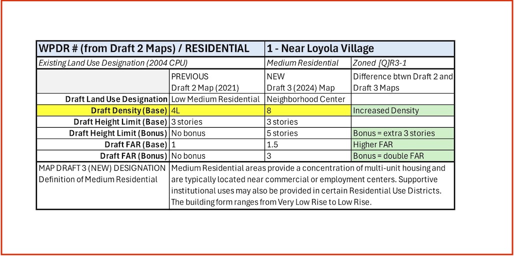
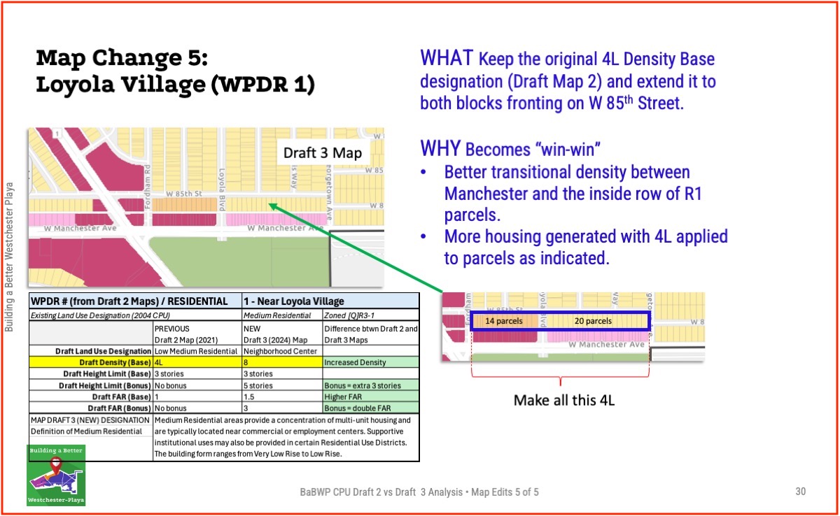
- Area: WPDR 1 / Loyola Village
- Change in both Land Use Category and Density Base
- Land Use Category Neighborhood Center = land uses that serve the needs of residents and employees, Very Low Rise to Low Rise, pedestrian scale commercial development. (Per LA General Plan definition.)
- Building Size Density Base 8
- Height Limit (Base) = 3 stories
- Height Limit (Bonus) = 5 stories
- Floor Area Ratio (FAR / Base) =1.5:1
- Floor Area Ration (FAR / Bonus = 3:1
Our Concern
Given the map changes between Draft 2 and Draft 3 result in an overall loss of future housing density, we are interested in finding as many places as possible to add back appropriate density changes to increase housing availability.
Our Map Change Recommendations
#1: Revert back to Draft 2 Map recommendation of Density Base
#2: Extend that 4L designation to include both blocks of parcels fronting on W 85st, between Fordham and Georgetown. (Going from 14 up-zoned parcels to 34.)
This creates a better transitional density between Manchester and the inside row of R1 parcels. And it generates more housing units.
Planning Definitions – Westside Community Plan Updates GPLU (2023)
General Plan Land Use (GPLU) – the basic character and functionality of a specific area, as defined by the options for land use in the City of LA’s General Plan for Housing.
GPLU Designation “Neighborhood Center” – Neighborhood Center areas are focal points for surrounding residential neighborhoods and include uses that serve the needs of residents and employees. The building form ranges from Very Low Rise to Low Rise, and is characterized by pedestrian-scale commercial development. Uses generally include a mix of residential and commercial uses, such as local businesses and services.
