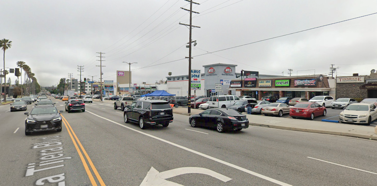
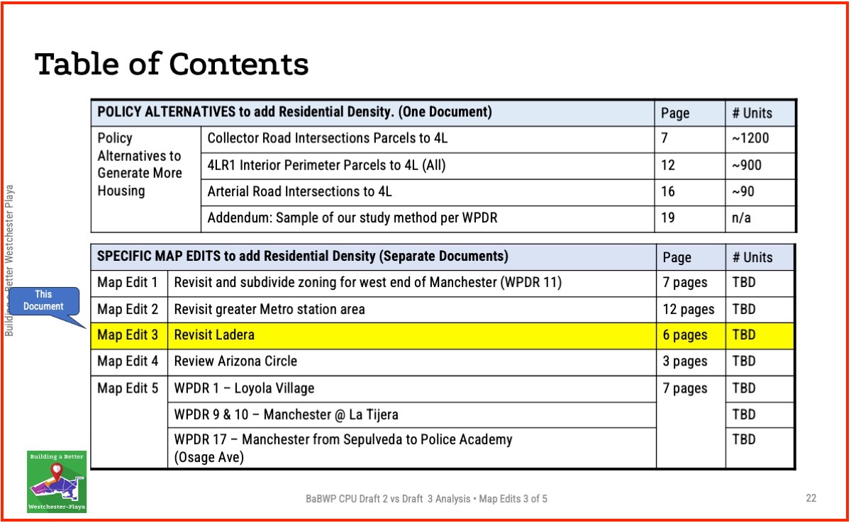
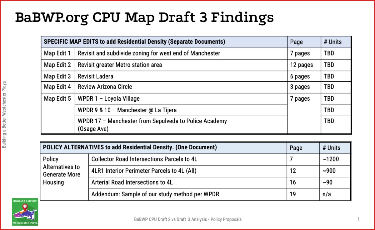
Draft 3 Map Recap / WPDR area 24 – Ladera
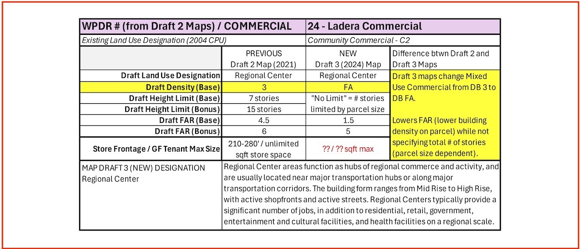
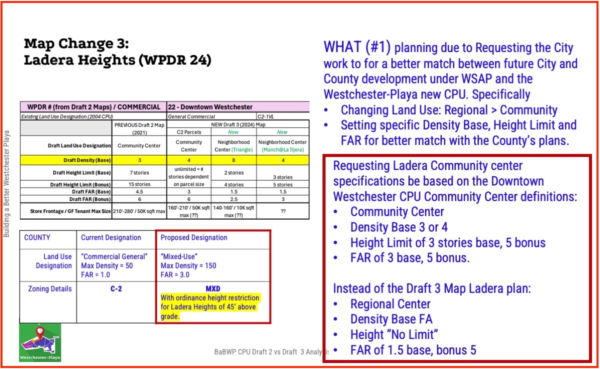
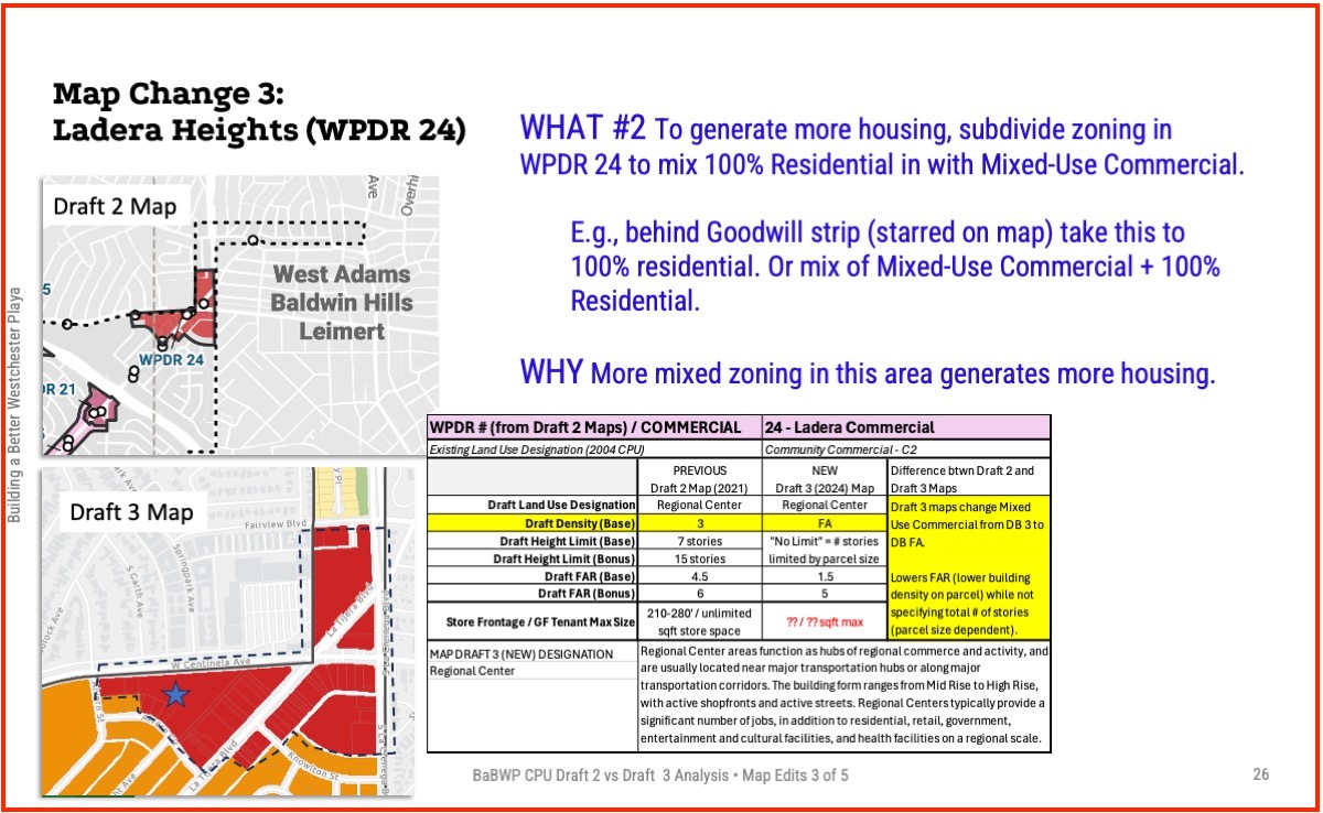
- Changes? Yes. Increase in Density Base 3 / Regional Center to Density Base FA / Regional Center
- Land Use Category Regional Center = functions as hub of regional commerce and activity; usually along major transportation corridors. Buildings range from Mid-Rise to High-Rise. (Per LA General Plan definition.)
- Building Size Density Base FA
- Height Limit (Base/Bonuse) = No # of stories specified; final # of stories based on parcel size.
- Floor Area Ratio (FAR / Base) = 1.5:1
- Floor Area Ration (FAR / Bonus = 5:1
Our Concerns
#1: Planning’s Draft 3 map pushes Ladera’s Land Use Designation (Regional Center) past what is spec’d for Downtown Westchester. This is inappropriate (per reasons given below) and unfair to the Ladera community.
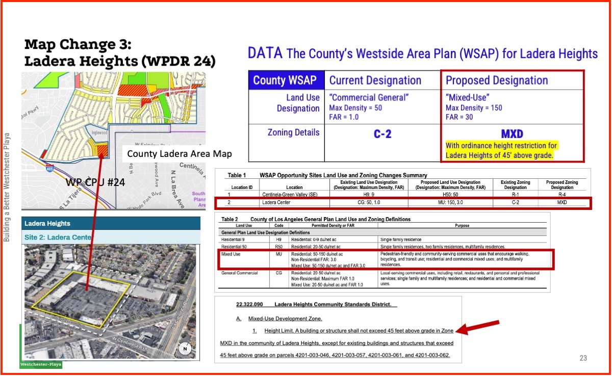
#2: Planning has not made an effort to create zoning that transitions more successfully with the LA County proposed plan update, which limits height to 45′. Specifics here:
#3: Planning has applied the Mixed Use Commercial zoning designation for the entirety of the up-zoned areas of Ladera, when some areas should be considered for 100% Residential zoning.
Our Map Change Recommendations
#1: Down-size Ladera’s GPLU designation from Regional Center to Community Center (same designation as downtown Westchester).
#2: Revise Density Base down to better integrate with LA County’s WSAP plan:
- Density Base: FA becomes Density Base 3 or 4
- Height: from “determined by parcel size” to 3 stories (base) / 5 stories (bonus).
- FAR: from 1.5:1 (base) / 5:1 (bonus) to whatever is most appropriate for DB3 or 4 [3:1 (base) / 5:1 (bonus)?]
#3: Subdivide WPDR 24 to mix in 100% Residential zoning with Mixed-Use Commercial. Specifically in the open parking lot area behind the Goodwill retail strip. (See blue star on map illustration.)
Planning Definitions – Westside Community Plan Updates GPLU (2023)
General Plan Land Use (GPLU) – the basic character and functionality of a specific area, as defined by the options for land use in the City of LA’s General Plan for Housing.
GPLU Designation “Regional Center” – Areas function as hubs of regional commerce and activity, and are usually located near major transportation hubs or along major transportation corridors. The building form ranges from Mid Rise to High Rise, with active shopfronts and active streets. Regional Centers typically provide a significant number of jobs, in addition to residential, retail, government, entertainment and cultural facilities, and health facilities on a regional scale.
GPLU Designation “Commercial Center” – Areas of vibrant activity typically located along commercial corridors, in concentrated nodes, or adjacent to major transit hubs. The building form ranges from Low Rise to Mid Rise, and may extend to Moderate Rise in the Downtown Community Plan. The use range is broad and may include commercial, residential, institutional facilities, cultural and entertainment facilities, and neighborhood-serving uses. The residential density general rates from 1 unit per 800 sq ft of lot area to 1 unit per 200 sq ft of lot area; residential density may also be limited by floor area.
